Get digitally reproduced photos from each decade, often beginning in the 1930’s and continuing to present day….
Learn moreSANBORN MAP® Report
Access the largest and most complete collection from the SANBORN MAP® Library
The SANBORN MAP Report is generated from the complete holdings of the SANBORN MAP Library, which dates back to 1866 and includes over 1.3 million SANBORN fire insurance maps.
Request A Demo Order Now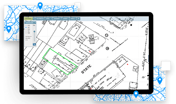
Key benefits
Access the largest collection of SANBORN MAPS
SANBORN MAPS show intricate details in buildings, properties and streets. They are one of the best sources of historical property information and are used every day by thousands of environmental consultants to conduct Phase I ESAs.
A single, seamless mosaic
Reviewing SANBORNS as part of your historical research has never been more convenient and integrated. The entire collection has been scanned into a high resolution, digital mosaic, enabling a single review experience in Lightbox.
LIGHTBOX EDR
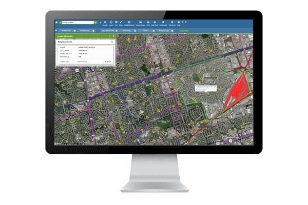
Review multiple years of SANBORN coverage with online tools that allow you to layer and switch between SANBORN MAPS, current aerial photos and Google Street View, and change the opacity of each layer to view multiple images simultaneously.
Validate your search with ease
Use the SANBORN certification number for documentation that shows you’ve searched the collection and are licensed to reproduce the map images in your report.
How LightBox EDR has improved your SANBORN® experience
A SINGLE, seamless MOSAIC
Since the entire collection has been rescanned into a seamless digital mosaic, reviewing SANBORN MAPS as part of your historical research has never been more convenient or valuable.
With Seamless SANBORN, your target property is centered in the middle of the SANBORN image, and the image will always be oriented north-up. With this improvement, turnaround time has been reduced, and the mosaic images are easy in fun to review in our online viewer, LightBox EDR.
LIGHTBOX EDR
Review multiple years of SANBORN® coverage with our online tools
Our Tools allow you to layer and switch between SANBORN MAPS, current aerial photos and Google Street View, and change the opacity of each layer to view multiple images simultaneously. Historical research has never been more convenient or valuable.
Access these powerful features through EDR LIGHTBOX® Data Viewer.
Unique certification number that can be used to validate your search
The SANBORN® certification number provides documentation that you have searched the complete SANBORN® Library collection, the largest and most comprehensive collection of SANBORN MAPS.
It also documents that you are licensed to reproduce the map images in your report.
SANBORN MAPS obtained from EDR®– authorized resellers will receive the same certification benefits.
Connected Data
Boundaries
Parcel Boundaries
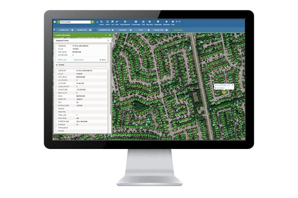
Nationwide parcel boundaries with 300+ property and tax attributes to help you make more confident decisions. Covers 3,100+ U.S. counties including territories, with over 150 million parcels with polygon geometry that is completely normalized.
Boundaries
Building Footprints
Building footprints are geospatial boundaries that provide the outline of a building drawn along the exterior walls.
Environmental
Flood Risks
Data includes, but is not limited to, 100-year and 500-year flood zones. Canadian Flood maps provide flood extents and depths for multiple return periods, covering river, surface and coastal flooding.
Environmental
Historical Imagery and Content
Collection of historical content including SANBORN® Maps, Historical Aerial Photography, Historical City Directories, Historical Topographic Maps, Environmental Liens and AULs, and Historical Title.
Environmental
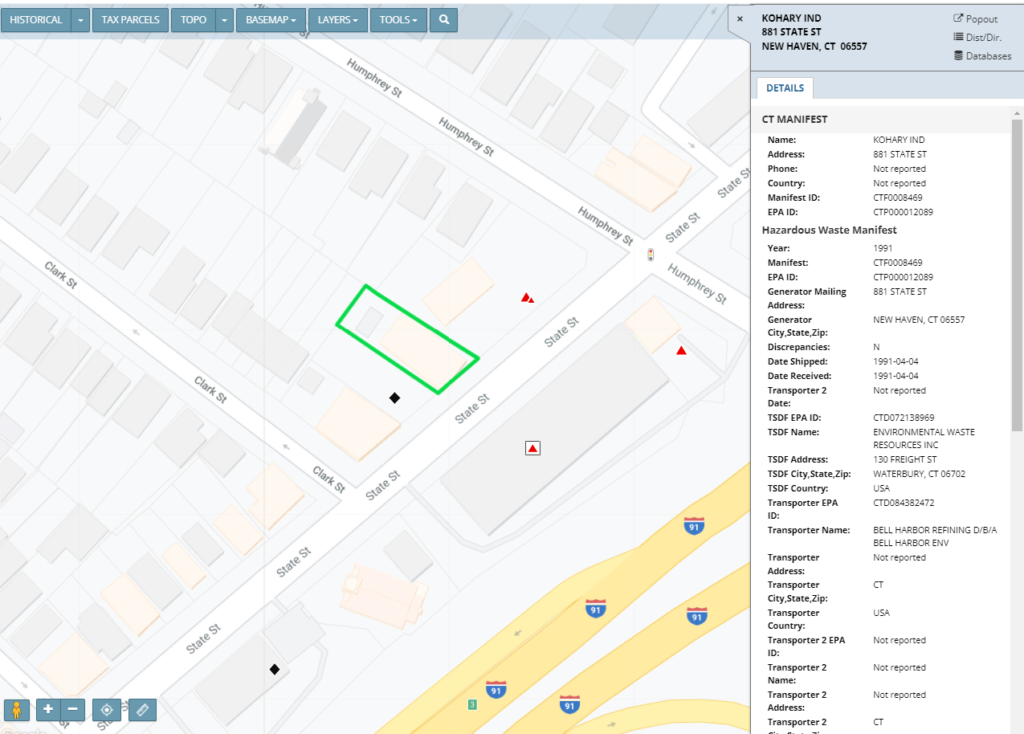
Known Incidents
Incidents identified by regulatory agencies indicating known or suspected environmental releases, contamination, or spills associated with hazardous materials, petroleum, or other products.
Environmental
Permitted Facilities
Facilities registered with regulatory agencies for operations such as hazardous waste management, landfills, underground and above ground storage tanks, and other activities associated with potential environmental concern.
Environmental
Other Environmental Content
Content valuable for evaluating environmental issues, including historical gas station and dry cleaners, PFAS, water wells, oil and gas wells, radon, wetlands, topography, endangered species, registered historic sites, and more.
Have questions? Want a demo? Let’s chat.
Fill out the form below and a member of our Sales Team will contact you shortly.
Recommended Insights
Environmental Due Diligence

USEPA Issues Expected Rule Designating PFAS as CERCLA Hazardous Substance
What It Means for Environmental Due Diligence of Commercial Real Estate The U.S. Environmental Protection Agency (EPA) announced the pending…
Data
The Changing Landscape of Data Center Zoning
As the exponential growth of digital businesses and AI continues to surge, the landscape of data centers is shifting. New…
Environmental Due Diligence

LightBox helps California Forever accomplish analysis for large-scale planning project with diverse datasets
“I’d recommend LightBox for any project that demands accuracy, versatility, and efficiency. They played a pivotal role in the success…