Get digitally reproduced photos from each decade, often beginning in the 1930’s and continuing to present day….
Learn morePlease be advised that there will be scheduled website maintenance from April 18th 10pm to April 19th 6am.
Please be advised that there will be scheduled website maintenance from April 18th 10pm to April 19th 6am.
The EDR LIGHTBOX® Data Viewer replaces the need to open and print dozens of PDFs and image files by compiling all the data and historical sources traditionally included in EDR® products in a single browser experience. All EDR® Packages and Radius Map orders include LightBox.
Request A Demo Order Now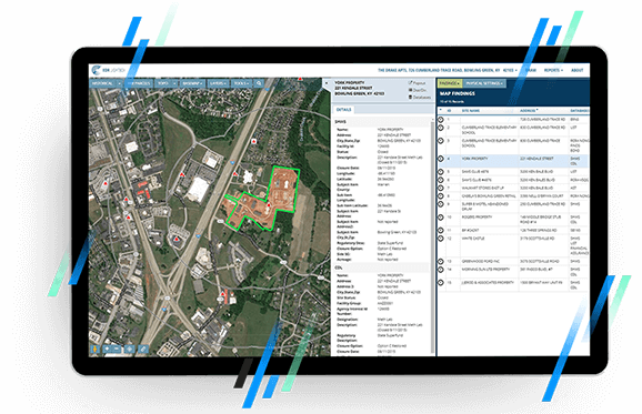
Lightbox brings your Phase I data into a single easy to use online viewer. The more data compiled, the more valuable Lightbox becomes, ensuring a comprehensive, high quality review.
Enjoy the clarity and precision of tax parcels and property boundaries integrated with historical resources and other critical data layers.
Use LightBox FIELDCHECK® to move sites, remove unnecessary findings, and plot unmapped sites.
Historical overlays, Google Street View, measuring tools, tax parcel data, and more, are all accessible within the application. EDR®’s VEC App is now included with every order, so the tools you need are ready when you need them.
EDR LIGHTBOX® just keeps getting better.
We’ve added more functionality to our fastest-ever growing product, allowing you to analyze vapor risks, move and adjust map findings, and improve the data powering your future reports.
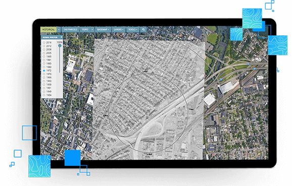
Analyze your EDR® Radius Map, SANBORN MAP®s, historical aerials, topographic maps, and more in a single browser.
Lightbox utilizes advanced tax-parcel georeferencing for fast, accurate review.
Historical overlays, Google Street View, measuring tool, tax parcel data and more are all accessible within the application.
EDR®’s VECApp is now included with every order, so the tools you need are ready when you need them.
With the addition of FIELDCHECK®, you can adjust search results in your EDR® Radius Map reports quickly and easily within Lightbox, improving report accuracy.
Building footprints are geospatial boundaries that provide the outline of a building drawn along the exterior walls.
Data includes, but is not limited to, 100-year and 500-year flood zones. Canadian Flood maps provide flood extents and depths for multiple return periods, covering river, surface and coastal flooding.
Collection of historical content including SANBORN® Maps, Historical Aerial Photography, Historical City Directories, Historical Topographic Maps, Environmental Liens and AULs, and Historical Title.
Fill out the form below and a member of our Sales Team will contact you shortly.